SIBERIAN FREEZE STRENGTHENS (-55.1C/-67.2F)
The Northern Hemisphere has just posted its coldest temperature of the season so far.
The location was Oymyakon, Russia with the low being the finger-snapping -55.1C (-67.2F) logged Sunday, Dec 4:
 Courtesy of @ThierryGooseBC on Twitter.
Asia’s cold has been widespread and fierce of late.
Serving as just a handful of examples, a low of -54.6C (-66.3F) was registered in Delyankir; -51.8C (-61.2F) in Agayakan; -50.5C (-58.9F) in Nera and -50C (-58F) in Yurty; while a record-challenging -41.9C (-43.4F) was logged in Tulihe, adding to the weather-related death and disruption sweeping Northern China:
NEW ZEALAND’S FROSTY START TO SUMMER
Meteorological summer has commended with freezing lows (C) in New Zealand.
Overnight lows have touched 0C (32F) in some spots, such as Manapouri, Fiordland, located on the South Island.
While in Australia, winter-like lows are persisting for many, with snow clipping the SE mountains.
And looking ahead, further anomalous chills are forecast for later in December, expected to hit the South and East hardest:
GFS 2m Temperature Anomalies (C) Dec 17 [tropicaltidbits.com].
ARCTIC AIR TO HIT EUROPE THIS WEEK, BRINGING HEAVY SNOW
Brutal Arctic air is readying to invade much of the European continent.
Record lows and historic snows are potentially on the cards as a ‘blocking high’ above Greenland threatens to set up a truly baltic-looking festive season, particularly for Northern, Western and Central nations — starting this week:
GFS 2m Temp Anomalies for early/mid-Dec (purples indicate 12C below average) for mid-Dec.
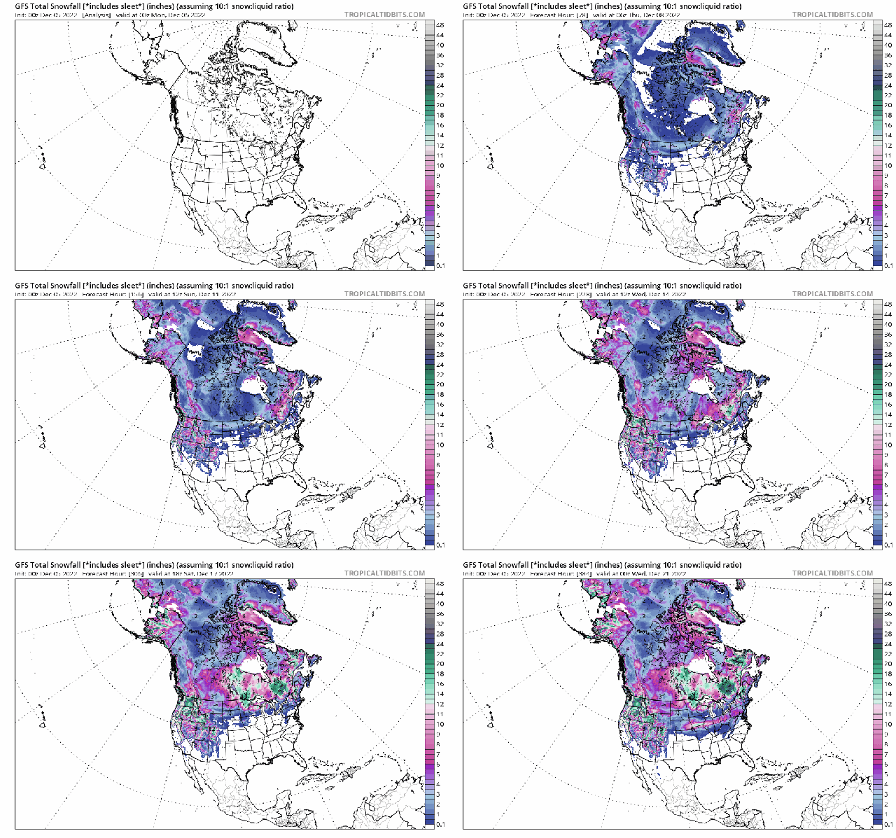
GFS Total Snowfall (inches) Dec 5 – Dec 21 [tropicaltidbits.com].
It’s a similar story across the pond, too, in North America.
Canada, in particular, is forecast record-breaking and deadly low temperatures (namely across Alberta and Sask.); while snow is on course to clip the majority of the continent, including deep into states such as Arizona and New Mexico:
GFS Total Snowfall (inches) Dec 5 – Dec 21 [tropicaltidbits.com].
This NH winter is setting up to be a doozy.
Total snowfall continues to march above the 1982-2012 average (see FMI chart in Electroverse sidebar).
While Greenland’s SMB growth continues its advance into uncharted territory:
[DMI]
The AGW Party has a lot of explaining to do…
Also, for more on the record-strong ‘blocking high’ building above Greenland, click below:
IS SOLAR CYCLE 25 ABOUT TO AWAKEN?
As we discussed on Friday, solar activity has –so far– been historically low during SC25 with only a handful of strong flares and no CMEs landing a direct hit on Earth. Over the past few days, however, the Sun has shown signs of stirring…
This picture below was taken by Eduardo Schaberger Poupeau of Rafaela, Argentina:
“The full disk of our star is suddenly showing a lot of activity,” said Poupeau.
Odds favor a geoeffective eruption –that’s one capable of causing a geomagnetic disturbance (on Earth)– this week.
The question: Is this just a temporary shift in gears, or an indication that something bigger is brewing?
Recommend this post and follow
The life of Earth


No comments:
Post a Comment
Stick to the subject, NO religion, or Party politics