https://electroverse.net/higher-elevations-of-north-america-set-for-6-feet-of-snow/
According to the latest models, the western half of the United States and much of Canada are set for an early blast of winter with 6 feet of snow falling across some of the higher elevations over the next 10 days.
The European Centre for Medium-Range Weather Forecasts (ECMWF) is calling for yet another record breaking mass of Arctic air to descend as far south as New Mexico and Texas over the coming days, forecast to deliver feet upon feet of early season snow to the mountain states of Colorado, Utah, Nevada, Wyoming, Idaho, and Montana.
California to the west should also expect feet of powder, as should Oregon and Washington to the north.
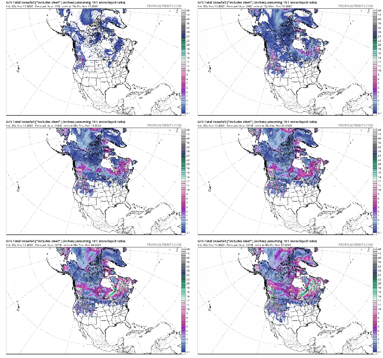
Starting today, Friday, November 13, record breaking cold and snow will bring treacherous driving conditions and the closures of many schools and businesses across multiple states -if mad COVID lockdowns don’t get to them first- with latest GFS runs suggesting the powerful wintry blast could last right up to Thanksgiving:
GFS Total Snowfall (inches) Nov 13 – Nov 26 [tropicaltidbits.com].
The picture looks even bleaker in northern Washington state and across the border into Canada’s British Columbia, where the ECMWF is calling for as much as 70.9 inches (5.91 feet) of “new snow” over the next 10 days alone.
Totals like these would be jaw-dropping at any time of the year, let alone mid-November, and they will only add to what has already been a “phenomenal” start to the snow season up there:
ECMWF “New Snow” Nov 13 to Nov 23 [www.windy.com].
Despite the prevalence of heavy snow and plunging Arctic cold, the scene actually remains one of constant change over the next 10-or-so days as a meandering jet stream, at times, will deliver out-of-season weather -both hot and cold, wet and dry- to almost every U.S. state. Pockets of cold will comfortably outnumber those of heat, but in-between those chilly blasts a wavy jet stream will occasional drive anomalous warmth up from the tropics — a routine occurrence in fall.
However, by the final week of November a dominating cold front looks set to take charge, one that is forecast to drag the majority of North American’s into a historically long, dark winter.
GFS 2m Temp Anomalies (C) for Weds, Nov 12 [tropicaltidbits.com].
Recommend this post and follow The Life of Earth
https://disqus.com/home/forum/lifeofearth/


No comments:
Post a Comment
Stick to the subject, NO religion, or Party politics